Interstates are a necessary evil. Here in the fourth largest State in the Union, to get anywhere fast you need the Interstates. To the visitor, our Montana interstate highways must seem deserted in comparison to other regions and some might think it's a little scary. Our Interstates have some spectacular scenery, but to the adventuresome motorcycle traveler offer little insight to Montana life and what lays beyond the ridge lines of pine and sage.
This weekend I made a quick trip to Missoula from Helena. Rain and thunderstorms were forecast yet the temperature was staying warm enough to enjoy a ride. A late departure time required use of the interstate to arrive in Missoula before Big Sky BMW closed for the weekend, but I planned a return trip that would take me off the beaten path into the forests and towns near the Blackfoot River. I jumped on the bike despite the bleak meteorological outlook.. and so glad I did.
Expecting poor weather and a wet ride home, Sunday welcomed me with near perfect conditions. After a hardy breakfast and a solid cup of coffee, I set forth towards Helena vowing not to touch an inch of Interstate, keeping only to two lane highways, frontage roads and as much dirt as possible. Entering the Blackfoot River Canyon near Bonner on Hwy 200 is always a welcome site; smooth and sweeping curves hug the river and walls of towering Ponderosa Pine trees. This mornings humid air didn't sting the eyes, so I opened the visor to get a whiff of forest air. The Blackfoot River is one of the finest trout streams in the world, but its also a popular tubing river for the residents of Missoula in search of relief from the summer sun. The canyon opens up into a wide valley near Potomac and it is here that I can see billowing clouds forming above the Continental Divide; like mountains themselves, they are the first sign of storms ahead. Will I get soaked?

First stop is the ghost town of Garnet. The last time I visited was nearly 10 years ago, so what a great opportunity to rediscover and explore this treasure. The road to Garnet, called the
Garnet Range Back Country Byway starts in the
Lubrecht Experimental Forest which is used by the University of Montana Forestry Program. The road climbs steadily and can't help but notice how healthy the forest looks with hardly a trace of pine beetle infestation. The temperature quickly drops and the pavement turns to dirt and the views of Bob Marshall Widlerness come into view.
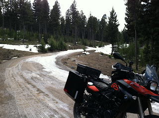
 |
Bob Marshall Wilderness from Ghost Town Byway
|
Six Miles into the forest I am thwarted by two feet of snow covering the road; it's too early in the season to get to Garnet by motorbike. Knowing that further progress is prohibited, thoughts quickly shift to plan B and I start to retrace steps back to Hwy 200.
 |
| Denied! |
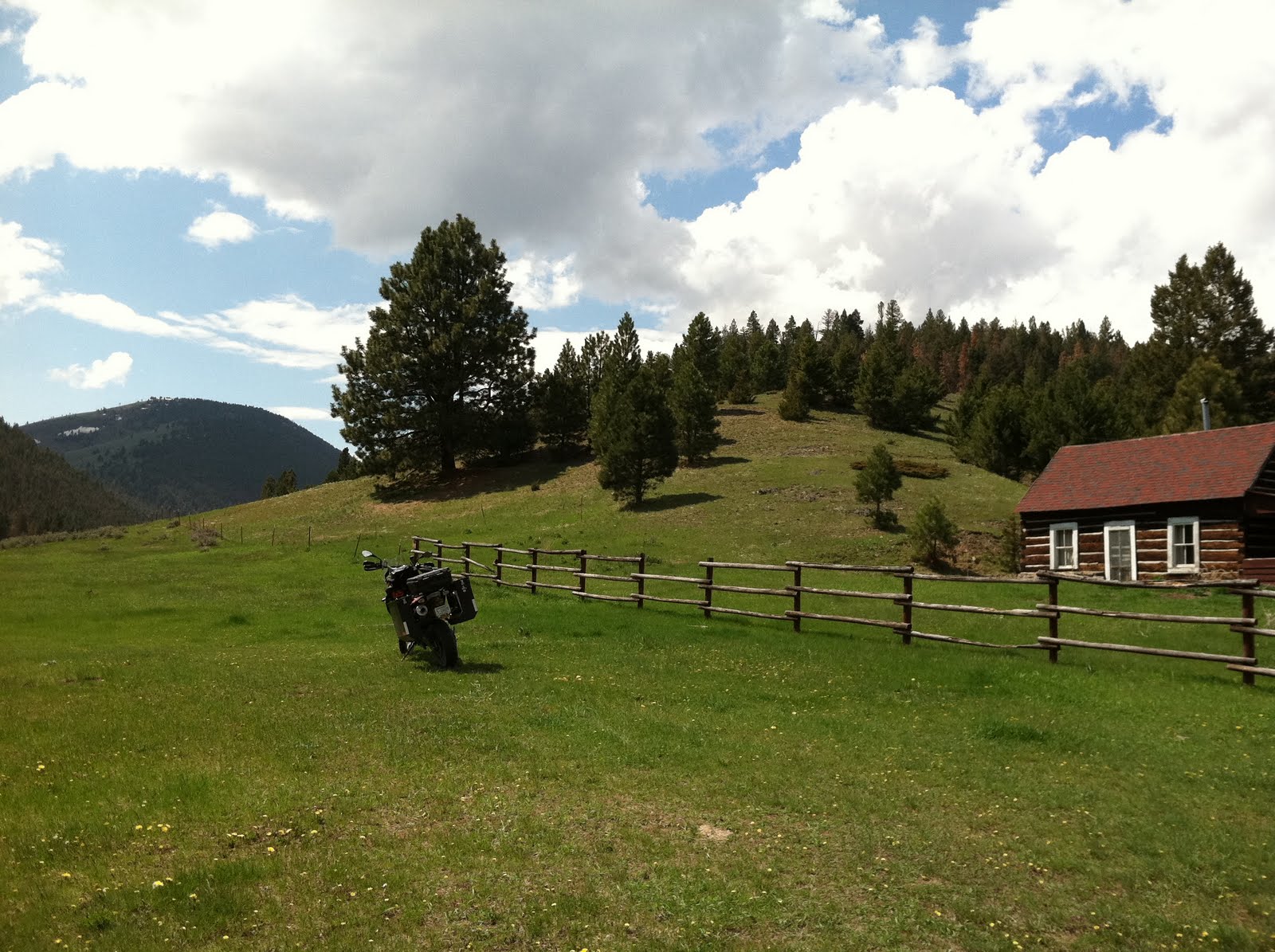
Once again heading east on Hwy 200, the road intersects with Montana Hwy 83 at Clearwater Junction and continues on into the Kleinschmidt Flats near Ovando. Having only been to Trixies Saloon near the highway, I venture into town to see what's there and stop at the
Blackfoot Commercial Co. & Inn for a cold drink. The BCC is owned by Howard and Peggy Fly and has a general store, hotel rooms, and gasoline pumps. They can even repair a tire for ya. Across the town commons, right out of the movies, is the Stray Bullet Cafe, home to some good grub. I must come back here some weekend, have dinner and beers and get a room in this quiet little town.
 |
| Blackfoot Commercial Co & Inn |
Noticing the growing storm clouds, I gather my gear and load up for home. I spent more time than expected in Ovando; its easy to do when chatting with locals and getting the scoop. Heading east again, Hwy 200 sweeps its way through the valley on its way to Lincoln. These upper parts of the Blackfoot River are the best for trout fishing, but none will be had today as the spring run off has swelled its banks and muddied its waters. At the yellow flashing light in the center of Lincoln, the road to Stemple Pass and the final leg of my days journey begins. Climbing up to the Pass, our forest looks dead. The pine beetle infestation brought havoc along the Continental Divide from Lincoln to Butte. Whole mountainsides are colored grey and copper. Amazing that such a small creature could do so much damage.
 |
| Stemple Pass Road |
Dropping from Stemple Pass the sun came out to warm my decent into the Helena Valley. A storm was brewing to the south over MacDonald Pass and I could see the grey streaks of rain reaching towards the ground near the my house; the race was on! After a quick stop for a couple of packs of Kettle House Beers and I made it into the garage just as the droplets of rain tapped on the pavement. Popping open a beer, I reflected on the days trip and how by, paraphrasing Robert Frost, taking the road less traveled has made all the difference. So glad I did.


No comments:
Post a Comment